
Mapa topográfico Morpeth
Mapa interactivo
Haga clic en el mapa para ver la altitud.
Morpeth
Cockle Park, located slightly north of Morpeth, contains a Met Office weather station, founded in 1897. The following table shows the climate data of the station from 1971–2000, recorded at 95 metres (312 ft) elevation.
Acerca de este mapa
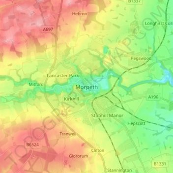
Nombre: Mapa topográfico Morpeth, altitud, relieve.
Altitud media: 70 m
Altitud mínima: 10 m
Altitud máxima: 136 m