
Mapa topográfico Kalimpong
Mapa interactivo
Haga clic en el mapa para ver la altitud.
Kalimpong
Kalimpong is a city and a municipality in the Indian state of West Bengal. It is located at an average elevation of 1,250 metres (4,101 ft). The city is the headquarters of the Kalimpong district. The Indian Army's 27 Mountain Division is located on the outskirts of the city.
Acerca de este mapa
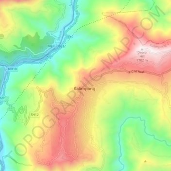
Nombre: Mapa topográfico Kalimpong, altitud, relieve.
Lugar: Kalimpong, West Bengal, 734301, India (27.03169 88.43290 27.11169 88.51290)
Altitud media: 838 m
Altitud mínima: 196 m
Altitud máxima: 1.683 m