
Mapa topográfico Finchampstead
Mapa interactivo
Haga clic en el mapa para ver la altitud.
Acerca de este mapa
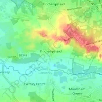
Nombre: Mapa topográfico Finchampstead, altitud, relieve.
Altitud media: 65 m
Altitud mínima: 44 m
Altitud máxima: 106 m
Otros mapas topográficos
Haga clic en un mapa para ver su topografía, su altitud y su relieve.
Finchampstead
United Kingdom > England > Finchampstead
Finchampstead, Wokingham, South East, England, RG40 4EE, United Kingdom
Altitud media: 67 m
Colebrook Lake North
United Kingdom > England > Finchampstead
Colebrook Lake North, Finchampstead, Wokingham, South East England, England, United Kingdom
Altitud media: 66 m