
Mapa topográfico Fuenlabrada
Mapa interactivo
Haga clic en el mapa para ver la altitud.
Fuenlabrada
Las Relaciones de Francisco Antonio de Lorenzana (1784) recogen una descripción sobre el nombre del pueblo, que ha sido asumida por el Ayuntamiento de Fuenlabrada como oficial. El siguiente texto se ha extraído de la edición actualizada de las Relaciones topográficas de Felipe II, coordinada por Alfredo Alvar Ezquerra.
Acerca de este mapa
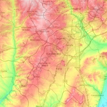
Nombre: Mapa topográfico Fuenlabrada, altitud, relieve.
Altitud media: 630 m
Altitud mínima: 495 m
Altitud máxima: 741 m